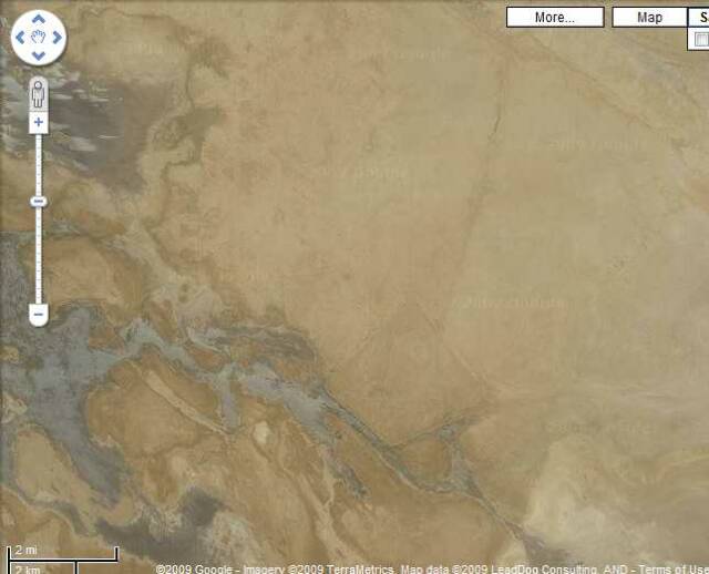
Eridu, Iraq Satellite Photos showing the Sebkha West of ancient Eridu flowing eastward as a stream to fill up the Sebkha east of Eridu. The trapzoidal levee wall about ancient Eridu and its seven mounds or tells is apparently a modern feature, perhaps erected in the 1980's (?) to prevent the area from being flooded (?) as the four levee walls have no openings in them. Access to the interior area behind the levee walls is via a road built atop a levee going north from Eridu to Ur. One has to drive "over" the NE levee wall to the parking lot (?) east of Tell of Abu Shahrain, ancient Sumerian Eridug, Akkadian/Babylonian Eridu. The gray areas show the flood waters of the Western Sebkha whose primary source of freshwater is a canal from the Euphrates which empties into the far west end of the Sebkha as revealed on other satellite photos. The Sebkhas' gray flood waters stream past the SW and SE levee walls in the below photo on their way to fill up the Sebkha east of Eridu (not shown on this photo). Note the map scale in the lower left corner, suggesting that the distance between the SW corner of the modern Eridu levee wall to the ancient tell of Eridu (Tell Abu Sharain) is roughly 2 miles. In antiquity the area within the modern levee walls probably flooded leaving Tell Abu Shahrain an island in a flooded plain for a few months during the flood season (May-July). No doubt the limestone retaining wall erected about the base of Eridu minimalized any erosion or washing away as dissolving mudbrick during the flood season. Please click here for more photos.
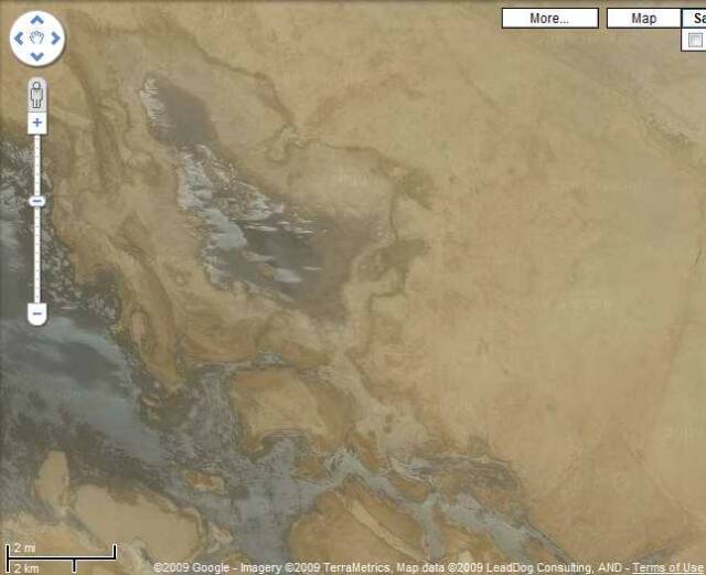
Below, a smaller Sebkha appears N of the larger Western Sebkha, perhaps it fills from the larger Sebkha via its SE opening which is "dry" in the below photo. Apparently (?) this photo was taken _after_ the northern Sebkha had filled from the Western Sebkha and the Sebkhas are now "receding" or "drying-up" the maximium high floodwater stage (May, June, July) having been earlier met and passed? Please click here for more photos.
Early scholarship in error thought Eridu had been situated at the shore of the Persian Gulf and maps since the 1890s show just such a situation. I understand that the Persian Gulf was never this far up. The shore which is mentioned in cuneiform documents is a freshwater lake's shoreline.
One scholar as early as 1925 noted that based on the finding of freshwater mussels in early layers near Eridu, by its archaeologist that it was not on the shore of the Persian Gulf, its shore was that of a freshwater lake:
"Captain R. C. Thompson, who dug at Eridu in 1918, noted quantities of freshwater mussels in the lower strata, which prove the city stood by a fresh-water lake. This fact and the considerations adduced below, suggest that we are not justified in assuming, as Professor Langdon appears to have done in the Cambridge Ancient History, Vol. 1, pp. 399-400 and Map 9 (inset), that these cities stood on the seaboard."
(p. 225. Arnold T. Wilson. "The Delta of the Shatt Al `Arab and Proposals for Dredging the Bar." The Geographical Journal. Vol. 65. No. 3. March 1925. pp. 225-239)