The below maps suggest for me that biblical Amalek, Hebrew Amaleq, "might" be preserved as an Arabic toponym in various forms, such as Malek, Mallaka, or Malaq, and Mallaqa, in locations like the Negev, the Hill Country of Judah and the Sinai, places associated in the Bible with this tribe.
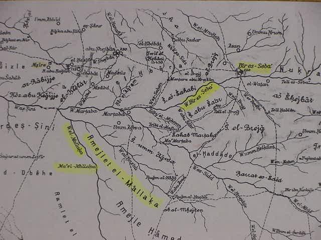
The below map is Alois Musil's Arabia Petraea (1:300,000 scale. Vienna, Austria. 1907) showing a Wadi el- M'allaka, Rmejlet el M'allaka and Ma'el M'allaka, all to the SW of Bir es-Seba (Beersheba). Rugm el-Hagg (Agag the Amalekite?) is E of Rmejlet el M'allak.
.
Below, Hohne shows Musil's (above) Wadi M'allaka as Wadi el Mu'alleqa with a nearby Bir el-Mu'alleqa
(cf. Ernst Hohne. Palastina Historisch-Archaologische Karte [Mit Einfuhrung und Register und Zwei vierzehnfarbige Blatter, 1:300,000]. Gottingen, Deutschland. Vandenhoeck & Ruprecht. 1981. ISBN 3-525-50157-9. A paperbound register of sites Stone Age to Islamic times, with two separate folding maps of a scale 1:300,000) This map is marked Sud Blatt, "South Sheet."
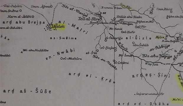
Below, Musil's site or city (?) in a strange sexagonal perimeter wall called Malek, showing buildings (?) to the W Tell al-Fare' (modern Tel Farah) W of Beersheba.
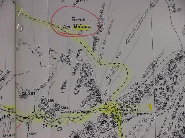
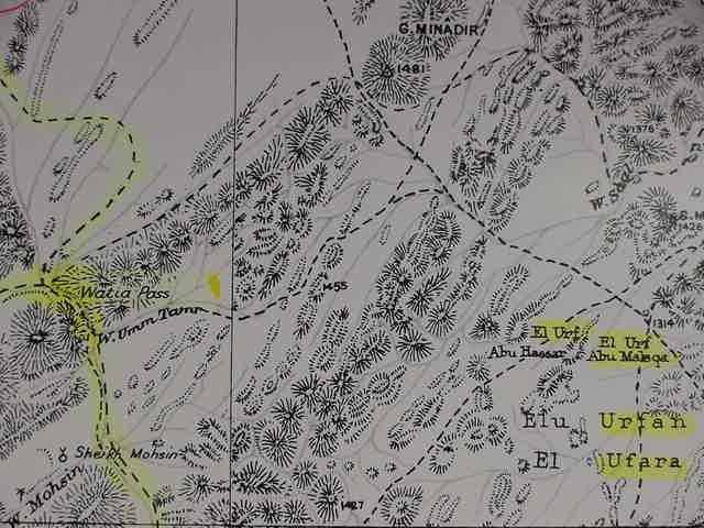
Below, the plain of Fersh Abu Malaqa in the southern Sinai, above the Watiya Pass, N of Saint Catherine's Monastery and the traditional Mount Sinai at Gebel Musa ( cf. map titled Gebel Katherina. Sheet 9. Survey of Egypt. Southern Sinai. 1:100,000. 1937). Note: Abu means "father" in Arabic.
Below, and highlighted, El Urf Abu Malaqa, a small plain, E of the Watiya Pass, in the southern Sinai.
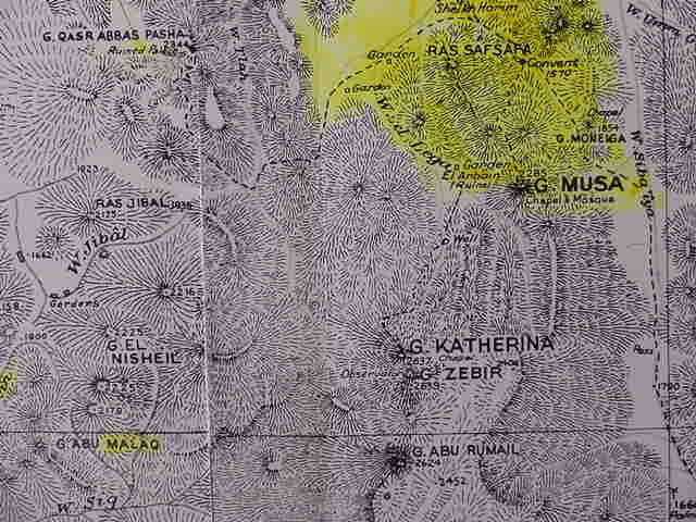
Below, Gebel Abu Malaq, a mountain to the W of Gebel Katharina (Catherine) and Gebel Musa. The Monastery of Saint Catherine's appears on this map as "convent" 1570 (elevation height). The plain north of Ras Safsafa is called er-Raha and some scholars believe Israel assembled here before the Holy Mount (Mount Sinai). Sheikh Harun above Ras Safsafa is where Aaron allegedly set up the Golden Calf for Israel to worship.
( cf. maps titled Feiran Sheet 8 and Gebel Katherina. Sheet 9. Survey of Egypt. Southern Sinai. 1:100,000. 1937).
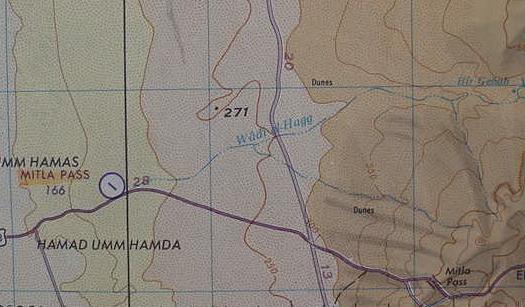
Below, Wadi el-Hagg (possibly preserving Agag, an Amalekite name?) near the Mitla Pass just E of the port of Suez. (cf. map titled Ismailia. Sheet NH 36-6. 1:250,000. Washington DC. 1970). The Bible suggests the Amakeites roamed as far west as Shur that is east of Egypt.
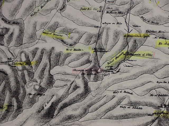
Below, Bir el Malaki, NW of Ghuwein et Tahta and Ghuwein el Foka. Wady el Mu'allak lies WNW of Bir el Malaki and N of Khirbet 'Attir (Palestine Exploration Fund Map. Sheet XXV. 1:63,000 scale. London. 1878)