Bozez and Seneh Crags between Michmash and Geba
11 May 2010 (Revisions through 19 May 2010)
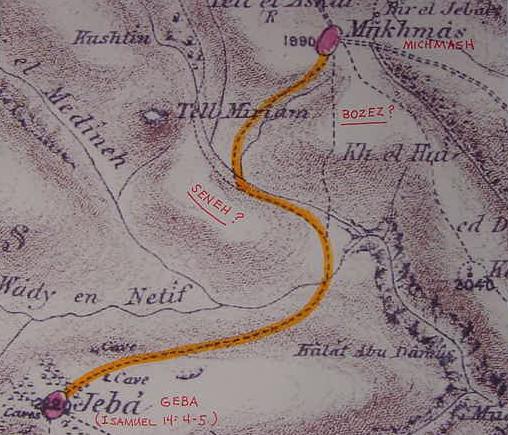
Bozez is described as a rocky crag in front of Michmash while Seneh is a rocky crag in front of Geba. I have marked in red ink where _I suspect_ the crags of Bozez and Seneh should be on the below map (Palestine Exploration Fund Map. London. 1878. Scale: 1:63,000)
1 Samuel 14:4-5 RSV
"In the pass, by which Jonathan sought to go over to the Philistine garrison, there was a rocky crag on the one side and a rocky crag on the other side; the name of the one was Bozez, and the name of the other Seneh. The one crag rose on the north in front of Michmash, and the other on the south in front of Geba."
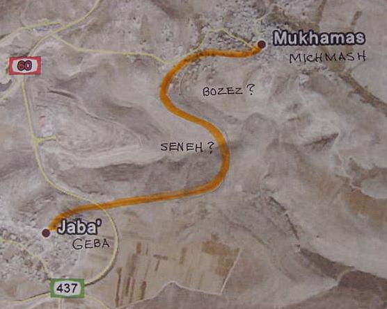
Below, a satellite view of Michmash and Geba showing a modern highway (Routes 60 and 437). The dirt-track-route Jonathan probably took between Geba and Michmash and the crags of Bozez and Seneh I have labeled in orange marker as per the above Palestine Exploration Fund Map earthen track of 1878. I have labeled in black marker where
_I believe_ Bozez and Seneh to be.
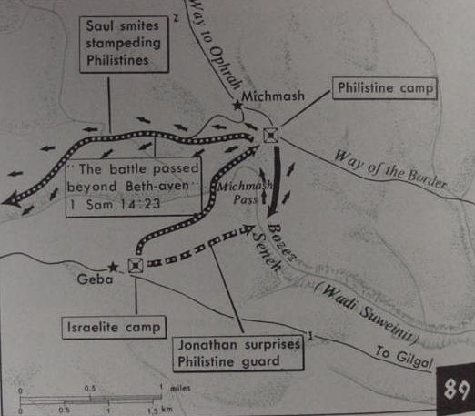
Israeli scholars Aharoni and Avi-Yonah (1968) locate Bozez and Seneh further south than my above proposal where rocky crags appear on either sie of Wady Suweini. They could be right! If so, then the Philistines were surprised by an enemy force that was able to sccale the cliff-face in this area (p. 70. Map Number 89. Yohanan Aharoni, Michael Avi-Yonah, Anson F. Rainey and Ze'ev Safrai. The MacMillan Bible Atlas. Revised 3rd edition. New York. MacMillan Publishing Company [Carta, The Israel Map & Publishing Company. Jerusalem. 1968, 1977, 1993]). Perhaps Wadi Suweinit preserves Seneh in Arabic?
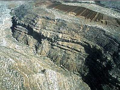
Below, aerial view of the rocky cliff face area on Wady Suweinit (Seneh?) where Aharoni and Avi-Yonah locate (?) the crags of Bozez and Seneh:
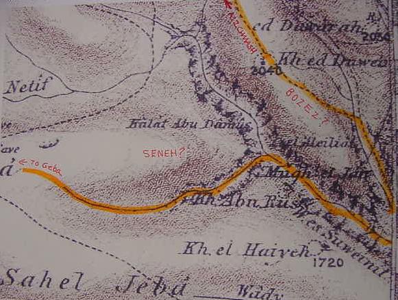
Possibly Bozez and Seneh are "in" Wadi Suweinit and the track (in orange marker) ascending the north of side of this wadi was the track Jonathan may have taken (?) to get to Philistine garrison at Michmash; this track is a "backdoor" to Michmash from Geba (PEF Map sheet 17. London. 1878)? I note that if the consonants are "reversed" for khirbet ed Duweb we get: B-E-W-U-D-D, allowing the two D's (ed Duweb) to be two Z's= BEWUZZ, Bozez? The track ascending Kh. ed Duweb/Bewuzz was the "backdoor" To Michmash from Geba?