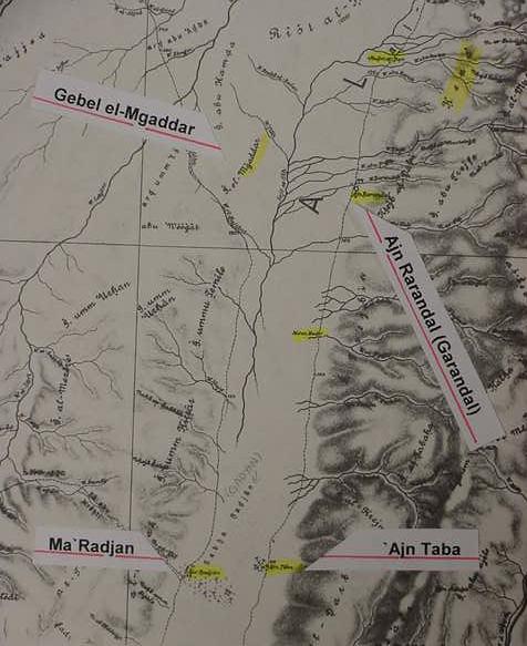
Perhaps Hor-haggidgad, LXX: Mount Gadgad (Nu 33:32) is Gebel el-Mgaddar (?) in the Arabah, across from Ain Garandal (Musil's `Ajn Rarandal. cf. Alois Musil. Karte von Arabia Petraea. 1907. 1;300,000) and Jotbathah (Nu 33:33) is Ain Taba, LXX: Etebatha (Musil's `Ajn Taba) across from Ma` Gadyan (Musil's Ma` Radjan) ? Israel is apparently heading south to the Gulf of Aqabah (biblical Yam Suph), skirting the western foothills of Seir/Edom, where a number of springs and wells are located, apparently fed by run-off from Seir's mountains.
This map accompanies my article titled