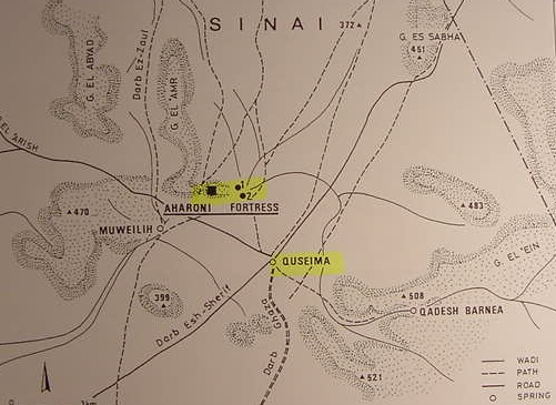
Map of Quseima (Biblical Azmon, Targum Kesam). The large black square represents an Iron Age "fortress" ca. 11th-10th century BCE atop a bluff overlooking the Quseima drainage plain. Number 1 is a smaller Iron Age fortress, contemporary with the larger and higher fortress. Number 2 is a Nabatean fortress. These fortresses were discovered in 1975 and excavated in 1981. (p.48, fig.1, "The 'Aharoni Fortress' Near Quseima and the Problem of Israelite Fortresses." Ze`ev Meshel.
Sinai, Excavations and Studies. Oxford. Archaeopress. 2000. ISBN 1-84171-077-6 pbk. pp.161).