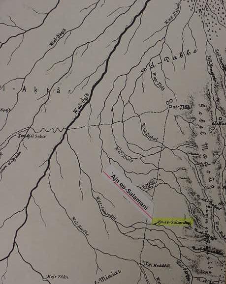
Zalmonah, LXX: Selmona (Nu 33:41), perhaps Ain Salamanyeh, Musil's `Ajn es-Salamani (?), near the western foothills of Seir/Edom, in the Arabah, south of the Dead Sea(Alois Musil. Karte von Arabia Petraea. 1:300,000. 1907); and so identified by Aharoni (cf. map no. 52, p. 48. "The Penetration into Transjordan." Yohanan Aharoni & Michael Avi-Yonah [revised by Anson F. Rainey & Ze`ev Safrai]. The Macmillan Bible Atlas. Jerusalem. Carta. 1993). My research suggests that Israel was traveling south toward the Gulf of Aqabah, biblical Yam Suph, skirting the western foothills of Seir/Edom where a number of springs and wells exist. This map accompanies my article titled "The Route of the Exodus."